


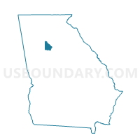
089RL - ROCK CHAPEL ROAD Voting District, DeKalb County, Georgia
About
Outline

Summary
| Unique Area Identifier | 561163 |
| Name | 089RL - ROCK CHAPEL ROAD Voting District |
| County | DeKalb County |
| State | Georgia |
| Area (square miles) | 7.93 |
| Land Area (square miles) | 7.66 |
| Water Area (square miles) | 0.27 |
| % of Land Area | 96.61 |
| % of Water Area | 3.39 |
| Latitude of the Internal Point | 33.72772110 |
| Longtitude of the Internal Point | -84.07590480 |
Maps


Graphs
Select a template below for downloading or customizing gragh for 089RL - ROCK CHAPEL ROAD Voting District, DeKalb County, Georgia


Neighbors
Neighoring Voting District (by Name) Neighboring Voting District on the Map
- 089LD - LITHONIA (LIT) Voting District, DeKalb County, GA
- 089PC - PRINCETON ELEM Voting District, DeKalb County, GA
- 089RF - ROCK CHAPEL ELEM Voting District, DeKalb County, GA
- 089RH - REDAN-TROTTI Voting District, DeKalb County, GA
- 089RI - ROCKBRIDGE ROAD Voting District, DeKalb County, GA
- 089SL - STONEVIEW ELEM Voting District, DeKalb County, GA
- 135122 - ROCKBRIDGE G Voting District, Gwinnett County, GA
- 247LA - THE LAKES Voting District, Rockdale County, GA
- 247SH - SHEFFIELD Voting District, Rockdale County, GA
Top 10 Neighboring County Subdivision (by Population) Neighboring County Subdivision on the Map
- Snellville-Grayson CCD, Gwinnett County, GA (148,651)
- Lithonia CCD, DeKalb County, GA (97,282)
- Conyers CCD, Rockdale County, GA (51,532)
- North Rockdale CCD, Rockdale County, GA (8,915)
Top 10 Neighboring Place (by Population) Neighboring Place on the Map
Top 10 Neighboring Unified School District (by Population) Neighboring Unified School District on the Map
- Gwinnett County School District, GA (793,941)
- DeKalb County School District, GA (644,266)
- Rockdale County School District, GA (85,215)
Top 10 Neighboring State Legislative District Lower Chamber (by Population) Neighboring State Legislative District Lower Chamber on the Map
Top 10 Neighboring State Legislative District Upper Chamber (by Population) Neighboring State Legislative District Upper Chamber on the Map
Top 10 Neighboring 111th Congressional District (by Population) Neighboring 111th Congressional District on the Map
Top 10 Neighboring Census Tract (by Population) Neighboring Census Tract on the Map
- Census Tract 507.09, Gwinnett County, GA (11,695)
- Census Tract 233.06, DeKalb County, GA (6,877)
- Census Tract 233.03, DeKalb County, GA (6,503)
- Census Tract 233.15, DeKalb County, GA (5,302)
- Census Tract 602.01, Rockdale County, GA (4,821)
- Census Tract 601.01, Rockdale County, GA (3,446)